Cymraeg / English

|
Caersws Basin Historic Landscape |
|
|
Back to description |
Historic Landscape Characterisation
Caersws Basin:
Maesmawr
Photographs of character area
|
|
|
|
|
|
|
|
|
Cymraeg / English
|
|
Historic Landscape CharacterisationCaersws Basin:
Maesmawr
|
|
|
|
|
|
|
|
|
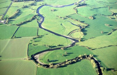 Aerial view of river Severn meanders near Dolhafren, to the east of Caersws. To the left the Roman road to Caersws is visible as an earthwork and hedge boundary running roughly parallel with the 19th-century turnpike road visible in the top left corner.
Photo: CPAT 06-C-08.
Aerial view of river Severn meanders near Dolhafren, to the east of Caersws. To the left the Roman road to Caersws is visible as an earthwork and hedge boundary running roughly parallel with the 19th-century turnpike road visible in the top left corner.
Photo: CPAT 06-C-08.
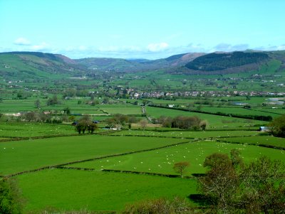 Ground level view of the Caersws Basin from the south-east with the village of Caersws in the middle distance.
Photo: CPAT 2272-06.
Ground level view of the Caersws Basin from the south-east with the village of Caersws in the middle distance.
Photo: CPAT 2272-06.