|
 Field pattern near Caeyroen, looking towards Upper and Middle Ochr-cefn and the mixed broadleaved and conifer woodland at Coed y Cefn.
Photo: CPAT 03-c-0593.
Field pattern near Caeyroen, looking towards Upper and Middle Ochr-cefn and the mixed broadleaved and conifer woodland at Coed y Cefn.
Photo: CPAT 03-c-0593.
|
|
|

|
|
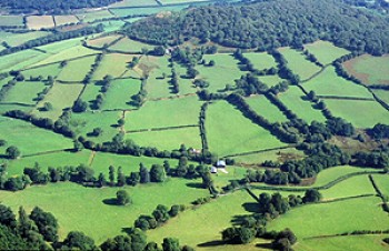
 Fieldscape along the Elan valley, looking towards Elan Village. The pattern of small regular fields in the vicinity of Coed-y-mynach farm, contrasting with the irregular fields elsewhere, may have originated from the medieval Cistercian grange centre here. A complex of earlier prehistoric burial and ritual sites has also been identified in this area from cropmark evidence.
Photo: CPAT 03-c-0691.
Fieldscape along the Elan valley, looking towards Elan Village. The pattern of small regular fields in the vicinity of Coed-y-mynach farm, contrasting with the irregular fields elsewhere, may have originated from the medieval Cistercian grange centre here. A complex of earlier prehistoric burial and ritual sites has also been identified in this area from cropmark evidence.
Photo: CPAT 03-c-0691.
|
|
|
|
|
|
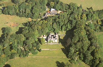 The Dderw country house and gardens The house was built in about 1870, partly retaining an earlier brick-built house of 1799, which had replaced an earlier house of perhaps the 16th century. The grass terraced gardens belong were added in about the 1920s.
Photo: CPAT 03-c-0567.
The Dderw country house and gardens The house was built in about 1870, partly retaining an earlier brick-built house of 1799, which had replaced an earlier house of perhaps the 16th century. The grass terraced gardens belong were added in about the 1920s.
Photo: CPAT 03-c-0567.
|
|
|
|
|
|
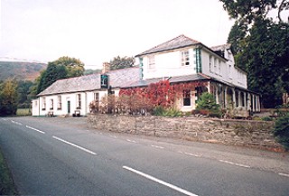 The Elan Valley hotel, on the road to Rhayader, built in 1893–94 to accommodate visitors and coach parties visiting the Elan Valley reservoirs.
Photo: CPAT 1538.04.
The Elan Valley hotel, on the road to Rhayader, built in 1893–94 to accommodate visitors and coach parties visiting the Elan Valley reservoirs.
Photo: CPAT 1538.04.
|
|
|
|
|
|
 The aqueduct carrying water from the Elan Valley to Birmingham. Here it crosses the Nant Caethon stream, just to the east of Elan Village.
Photo: CPAT 1540.17.
The aqueduct carrying water from the Elan Valley to Birmingham. Here it crosses the Nant Caethon stream, just to the east of Elan Village.
Photo: CPAT 1540.17.
|
|
|
|
|
|
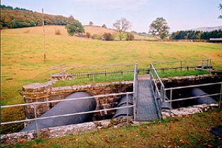
 Brick-built washout chamber near Coed-y-mynach farm, just to the east of Elan Village. The building is characteristic of the structures which appear along the line of the aqueduct from the Elan Valley across the Midlands towards Birmingham.
Photo: CPAT 1540.15.
Brick-built washout chamber near Coed-y-mynach farm, just to the east of Elan Village. The building is characteristic of the structures which appear along the line of the aqueduct from the Elan Valley across the Midlands towards Birmingham.
Photo: CPAT 1540.15.
|
|
|
|
|
