Cymraeg / English

|
East Fforest Fawr and Mynydd-y-glôg Historic Landscape |
|
|
Back to description |
Historic Landscape Characterisation
East Fforest Fawr and Mynydd-y-glôg:
Mynydd y Garn
Photographs of character area
|
|
|
|
|
|
|
|
|
|
|
|
|
|
|
|
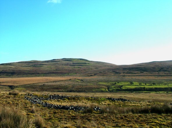 Stone banked enclosure in the moorland area towards the head of Dyffryn Hepste, looking south-eastward to fields belonging to the isolated Hepste-fechan encroachment in the middle distance and Cefn Cadlan on the horizon.
Photo: CPAT 2509-86.
Stone banked enclosure in the moorland area towards the head of Dyffryn Hepste, looking south-eastward to fields belonging to the isolated Hepste-fechan encroachment in the middle distance and Cefn Cadlan on the horizon.
Photo: CPAT 2509-86.
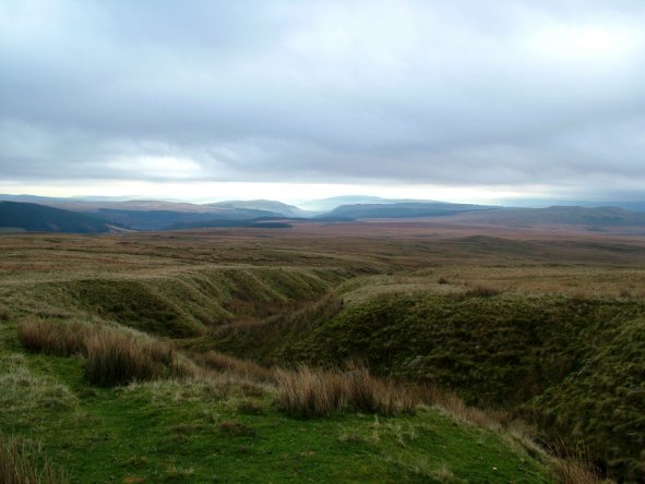 The deeply incised stream valley of the Afon y Waun in the moorland below Fan Fawr, looking southwards towards Dyffryn Hepste and Cwm Cadlan.
Photo: CPAT 2509-11.
The deeply incised stream valley of the Afon y Waun in the moorland below Fan Fawr, looking southwards towards Dyffryn Hepste and Cwm Cadlan.
Photo: CPAT 2509-11.
 Aerial view of Fan Fawr, the second highest peak of the Brecon Beacons, viewed from the south. In the foreground are the Nant Llywarch and Afon y Waun streams, tributaries of the Afon Hepste. Part of the extensive network of drainage channels cut in the 1940s around the headwaters of the Afon Hepste are visible in the left foreground.
Photo: CPAT 08-C-82.
Aerial view of Fan Fawr, the second highest peak of the Brecon Beacons, viewed from the south. In the foreground are the Nant Llywarch and Afon y Waun streams, tributaries of the Afon Hepste. Part of the extensive network of drainage channels cut in the 1940s around the headwaters of the Afon Hepste are visible in the left foreground.
Photo: CPAT 08-C-82.
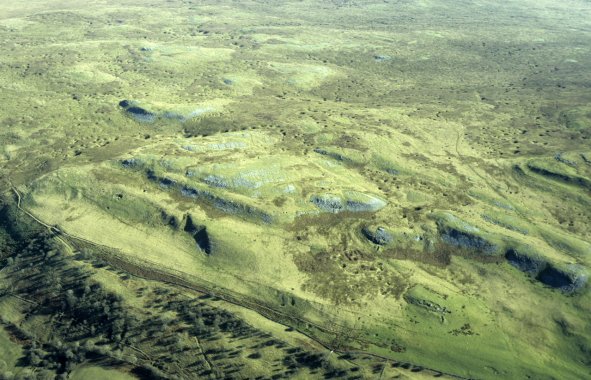 Aerial view of limestone outcrops on Carn y Goetre and Twyn Croes Gwallter, viewed from the south-west. Just visible in the right foreground is a cluster of small quarry workings and limekilns near Llwyn-onn. Visible in the background are some of the numerous shakeholes on Mynydd y Garn.
Photo: CPAT 08-C-21.
Aerial view of limestone outcrops on Carn y Goetre and Twyn Croes Gwallter, viewed from the south-west. Just visible in the right foreground is a cluster of small quarry workings and limekilns near Llwyn-onn. Visible in the background are some of the numerous shakeholes on Mynydd y Garn.
Photo: CPAT 08-C-21.