Cymraeg / English

|
East Fforest Fawr and Mynydd-y-glôg Historic Landscape |

|
Character area map |
|
|
More photographs |
Historic Landscape Characterisation
East Fforest Fawr and Mynydd-y-glôg:
Garreg-fawr
Ystradfellte community, Powys
(HLCA 1200)
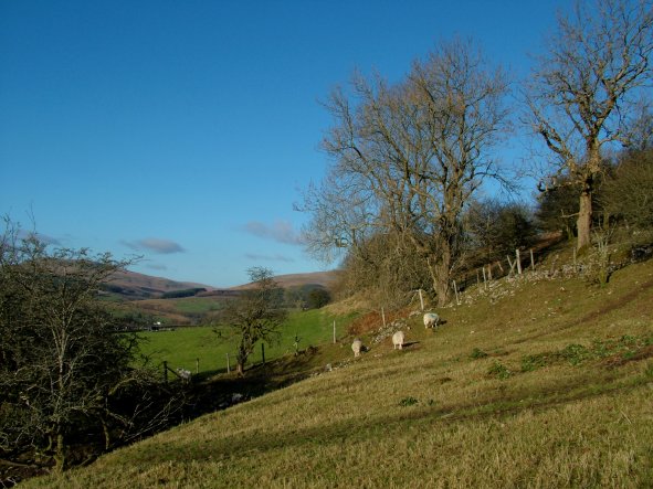
Fieldscapes and farmsteads probably of later medieval and post-medieval origin high on the eastern edge of the Mellte valley, just below the moorland edge.
Environmental and historical background
Narrow strip of about 95 hectares of fieldscapes on the western boundary of the historic landscape area. The eastern boundary of the characterised area is drawn to mark the edge of the unenclosed moorland. The somewhat arbitrary western boundary of the characterised area largely follows that indicated in the historic landscapes register, though for convenience it has been drawn to match more explicitly modern roads and property boundaries. Topographically, the area forms part of the west-facing, upper, eastern edge of the valley of the Afon Mellte.The underlying solid geology is predominantly Carboniferous Limestone, with some shake holes and a large swallow hole named Pwll Derw into which a stream drains. The soils are predominantly seasonally waterlogged loamy soils of a kind which historically have been best suited to stock rearing on short-term grassland and some cereals in drier areas.
Some of the farms and boundaries near Pen-fathor are shown on an estate map of the Hon. George Venables Vernon, dated 1776. Many other properties and boundaries are first shown on the Ystradfellte tithe map of 1840. Most of the area had already been enclosed at the time of the Brecknock Forest (Fforest Fawr) enclosure acquired by Christie in 1818, part of which lay immediately to the north and east. Until local government reorganisation in 1974 the area fell within the Breconshire civil parish of Ystradfellte.
Key historic landscape characteristics
There are few place-names that are of significance to the settlement or land use history of this small character area. Tyr-llyn is derived from the place-name element tir ‘land, territory’ or possibly ty (‘house’) but is of modern origin. The former building at Cae’r-prydydd contains the element cae (‘hedge, fence, field, enclosure’) and the proper name Prydydd.The lower-lying parts of the area are mostly occupied by a pattern of small irregular fields probably largely of later medieval to early post-medieval origin and also includes some enclosed fields which have now reverted to moorland. Some of these boundaries are shown on an estate map of the 1770s as ‘old banks’. The southern end historically formed part of an area of enclosed upland pasture subdivided from the moorland of Gwaun Cefnygarreg by a post-medieval drystone wall; this area subsequently formed part of a more extensive 20th-century conifer plantation (felled in 2007). Other boundaries are mostly drystone walls though field banks and hedges also occur. Agricultural land use is also indicated by existing sheepfolds near Pen-fathor-uchaf, some of which are shown on an estate map of the 1770s. Present-day land use is predominantly pasture.
The farms and former farm complexes at Garreg-fawr, Goitre, Llwyn-onn and Pen-fathor were all in existence by at least the later 19th century. Pen-fathor-uchaf and Pen-fathor-isaf farms are shown on an estate map of the 1770s and the sites of former buildings possibly of earlier farms, then in a ruinous condition, are shown at Goitre and Llwyn-onn on Ordnance Survey maps of the 1880s. Investment in farming during the 19th century is illustrated by the existing 19th-century houses and some outbuildings at Goitre and Garreg-fawr.
The area includes a number of significant industrial and transport remains. These include scattered, probably 19th-century limekilns and small quarries near Llwyn-onn, between Tyr-llyn and Pen-fathor-uchaf, and towards the southern end of the area, and part of the course of the former railway running southwards to Penderyn, built to transport materials used for the construction of the Ystradfellte Reservoir as a water supply for Neath between 1907 and 1914. The former railway, which survives partly as an embankment and partly as a trackway along part of the western boundary of the area, forms a distinctive landscape feature which is partly lined with mature conifers.
Sources
Historic Environment Record; Ordnance Survey 1st edn 1:2,500; Leighton 1997; Soil Survey of England and Wales 1983; http://www.breconbeacons.org/content/geopark/understanding/archaeology-industrial-heritage/reservoir-of-fforest-fawr-geopark (accessed on 29-11-07); Glamorgan Record Office WGRO D/D BF E/164 (map of the estate of the Hon. George Venables Vernon, 1776); Jones and Smith 1972a; Thomas 1992; Kain and Chapman 2004; Chapman 1991.For further information please contact the Clwyd-Powys Archaeological Trust at this address, or link to the Countryside Council for Wales' web site at www.ccw.gov.uk.
Privacy and cookies