
Cymraeg / English
|

|
Historic Landscape Characterisation
East Fforest Fawr and Mynydd-y-glôg:
Dyffryn Hepste
Photographs of character area
|
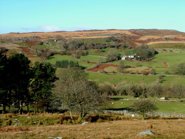 Enclosed fields of probably medieval or earlier origin in the Hepste valley defined by drystone walls and clearance banks, looking north-eastwards towards Llwyn-y-fedwen, with the rocky outcrops of Garreg Lwyd on the horizon.
Photo: CPAT 2509-65.
Enclosed fields of probably medieval or earlier origin in the Hepste valley defined by drystone walls and clearance banks, looking north-eastwards towards Llwyn-y-fedwen, with the rocky outcrops of Garreg Lwyd on the horizon.
Photo: CPAT 2509-65.
|
|
|
|
|
|
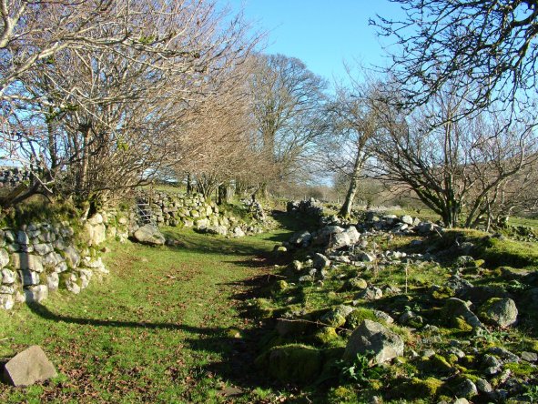 Green lane probably of probably medieval or earlier origin near the appropriately named Heol-Las (‘Green Lane’), bounded by now dilapidated drystone walls and clearance banks.
Photo: CPAT 2509-76.
Green lane probably of probably medieval or earlier origin near the appropriately named Heol-Las (‘Green Lane’), bounded by now dilapidated drystone walls and clearance banks.
Photo: CPAT 2509-76.
|
|
|
|
|
|
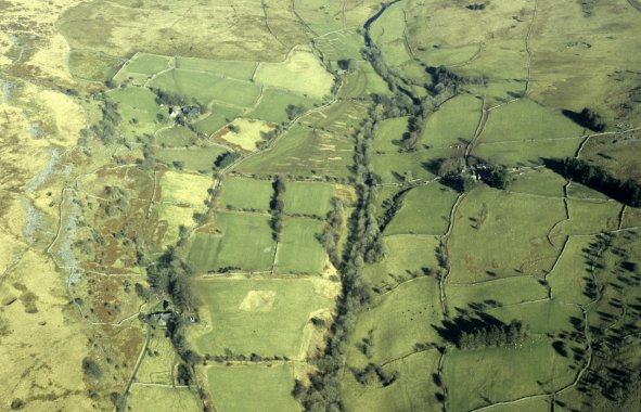 Aerial view of a mature landscape of fields and farms towards the head of the Hepste valley, with the wooded banks of the Afon Hepste at the centre . Many of the fields are irregular in shape, illustrating a long and gradual evolution. Judging by the surviving remains in the moorland in the background it is likely that many of the fields here owe their origin to a process of clearance and enclosure which first began during the Bronze Age. The square fields towards the centre probably represent a reorganisation of some of the field boundaries in the 19th century, when it is clear that some investment in farming was being made. The present farmhouse at Hepste Fawr, in the left foreground, had its origins as a medieval longhouse. The farms in the valley are linked by a network of roads, tracks and green lanes which allowed animals to be herded from the farms up to the mountain pastures.
Photo: CPAT 08-C-29.
Aerial view of a mature landscape of fields and farms towards the head of the Hepste valley, with the wooded banks of the Afon Hepste at the centre . Many of the fields are irregular in shape, illustrating a long and gradual evolution. Judging by the surviving remains in the moorland in the background it is likely that many of the fields here owe their origin to a process of clearance and enclosure which first began during the Bronze Age. The square fields towards the centre probably represent a reorganisation of some of the field boundaries in the 19th century, when it is clear that some investment in farming was being made. The present farmhouse at Hepste Fawr, in the left foreground, had its origins as a medieval longhouse. The farms in the valley are linked by a network of roads, tracks and green lanes which allowed animals to be herded from the farms up to the mountain pastures.
Photo: CPAT 08-C-29.
|
|
|
|
|
|
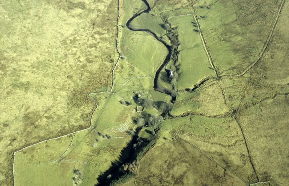 Abandoned farms, cottages and ancient fields of probably medieval origin on the banks of the Afon Hepste near Blaen-Hepste and Tir-yr-onen.
Photo: CPAT 08-C-40.
Abandoned farms, cottages and ancient fields of probably medieval origin on the banks of the Afon Hepste near Blaen-Hepste and Tir-yr-onen.
Photo: CPAT 08-C-40.
|
|
|
|
|
|
