Cymraeg / English

|
Mynydd Hiraethog Historic Landscape |

|
Character area map |
Historic Landscape Characterisation
Mynydd Hiraethog:
Moel Bengam
Llansannan Community, Conwy
(HLCA 1107)
Unenclosed moorland, common land; sheepfolds, large round cairn, boundary markers on parish boundary and ruined Edwardian shooting lodge.
Historic background
The area falls within the 19th-century tithe parishes of Llansannan and Henllan. Little recent archaeological fieldwork has been undertaken within the area and relatively few traces of human activity have been recorded within the area.
Key historic landscape characteristics
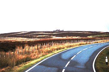
The character area occupies an area of about 13.5km2 of undulating heather moorland towards the northern scarp of Mynydd Hiraethog, to the east of Aled Isaf Reservoir, between a height of about 280-490m above Ordnance Datum, and includes the summits of Moel y Bryniau, Bryn Trillyn and Cefn Tan-y-graig as well as Moel Bengam itself. The area is predominantly north-facing. The area is drained by a series of streams including the Nant-y-foel-ddu, Nant-y-foel-frech, Nant Trwyn-swch, tributaries of the Afon Aled, and by the Afon Hyrdd and Nant y Fleiddiast, all of which drain into the Afon Elwy river system.
Little or no settlement evidence of any period has been identified within the character area. Evidence of land use is largely restricted to several sheepfolds in the valley of the Nant y Foel, towards the head of the Afon Aled, east of Aled Isaf Reservoir. The boundary between the Llansannan and Henllan tithe parishes runs across the area and is marked on the ground by a substantial earth bank and ditch and by a series of boundary stones at 500-700m intervals shown on the Llansannan tithe map of 1841.
The area includes the small natural upland lake of Llyn-y-foel-frech covering an area of about 1.75ha in the basin between Moel y Bryniau and Trwyn Swch, at a height of about 400m above OD as well as a number of areas of peat bog, all of which potentially preserve waterlogged deposits of potential significance to the environmental and land use history of Mynydd Hiraethog.
A large prehistoric burial mound lies on the lower slopes of Rhos Bryn-llwyn, towards the northern side of the area. The burial mound appears to be deliberately sited to overlook the lower-lying and now enclosed land to the east, within the valley of the Afon Hyrdd.
The area is crossed by a number of footpaths and trackways, probably of some antiquity, which link the farms in the valley of the Afon Hyrdd, to the north of the area, with Llyn Aled and the head of the Afon Aled.
The gaunt ruins of the early 20th-century shooting lodge of Gwylfa Hiraethog lie towards the eastern side of the area, within an enclosure spanning the boundary of the parishes of Llansannan and Henllan at a height of just under 500m above OD on the summit of Bryn Trillyn. The building, one of the dominant landmarks of Mynydd Hiraethog, was built as a shooting lodge for the Merseyside entrepreneur Hudson Ewbanke Kearley, 1st Viscount Devonport, first built in 1908 but substantially remodelled in 1913.
Sources
CPAT Sites and Monuments Record;
Hollett 2000;
Hubbard 1986;
Lloyd 1985
For further information please contact the Clwyd-Powys Archaeological Trust at this address, or link to the Countryside Council for Wales' web site at www.ccw.gov.uk.
Privacy and cookies