Cymraeg / English

|
Maelor Saesneg Historic Landscape |

|
Character area map |
Historic Landscape Characterisation
Maelor Saesneg:
Emral
Hanmer and Willington Worthenbury communities
(HLCA 1121)
 Former17th-century landscape park with buildings and structures associated with now-demolished country house belonging to important Anglo-Welsh borderland family.
Historic background
The historic landscape area is focused on the now-demolished Emral Hall, the seat of the Puleston family, an important Anglo-Welsh family in the borderlands, who resided there in uninterrupted succession between the reign of Edward I and the 1930s when the estate was sold off and the house demolished. The family derived their name from the manor of Pilston or Puleston new Newport, Shropshire, Sir Roger de Puleston, a trusted officer of the king and associated with 'Embers-hall' in 1283, probably being the first of his line to establish a seat here in the wake of the conquest of Wales. He was appointed first sheriff of Anglesey and as such was responsible for levying the unpopular tax on moveables which precipitated the revolt led by Madog ap Llywelyn in the autumn of 1294, during the course of which he lost his life in a Welsh raid on the borough of Caernarfon. The early hall was most probably associated with a moated site of which the Emral Brook is thought to have formed the eastern side. Like a number of other prominent local families of English origin the Pulestons were later to become fully absorbed within Anglo-Welsh cultural and political life, becoming patrons of many Welsh poets, including Guto'r Glyn, Gutun Owain and Lewys Glyn Cothi, for successive generations between the mid 14th century and the end of the 16th. Robert Puleston was one of a number of prominent landowners in Maelor Saesneg who had sided with Owain Glyn Dwr at an early stage of the Welsh rebellion in the early years of the 15th century. A chapel dedicated to St Thomas the Martyr existed here in the 1440s which was demolished in the 1770s.During the Civil War the king's forces were billeted at Emral in 1642, possibly within a later medieval hall which had replaced an earlier hall at the site. Sir John Puleston (c. 1583-1659) judge, lived at Emral Hall in 1650s, installed Philip Henry as minister of Worthenbury of which he had bought the advowson, and tutor to his children. Henry lived at Emral until Puleston built him a house at Worthenbury, said of his patron that in renewing leases on the estate he substituted for the customary obligation of keeping a hound or a hawk for the landlord to that of keeping a Bible in the house.
A new larger house was built in about the 1660s, which together with additions in the 1720s and 1890s probably extended over parts of the earlier moat. The house was demolished in 1936 and considered to be a serious architectural loss. Much material was used to fill in the remains of the moat though parts of the house were re-erected at Portmeirion by the architect Clough Williams-Ellis.
Key historic landscape characteristics
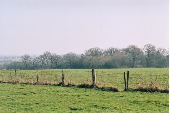
The historic landscape character area occupies gently sloping ground along the banks of the Emral Brook, generally between about 15-30 metres above Ordnance Datum and despite the demolition of Emral Hall itself still contains many characteristic traces of a country house cultural landscape. Surviving from the early 18th-century are two brick-built stable blocks and courtyard, partly forming part of the present Emral Stud and partly converted to residential use, designed by the same architect as the well-known Georgian church dedicated to St Deiniol at Worthenbury. Contemporary with the stable blocks are the single-span stone bridge with brick parapets, formerly with 'pepper-pot' guardrooms to either side, which originally lay on the main drive to the house, together with the partly subterranean circular brick ice-house with domed roof. Two of the original three lodges survive, the fabric being predominantly of 19th-century date.A large oval enclosure marks the boundary of the small landscape park, probably of 18th-century origin, which once surrounded the former hall. There are widespread traces of ridge and furrow cultivation within the parkland boundary which probably represent medieval open field contemporary with the medieval hall and moated site, first emparked in perhaps the 17th or 18th century. Present-day land use is predominantly grassland, subdived by post and wire fences.
Sources
Harrison 1974Hubbard 1986
Jones 1933
Lee 1888
Lewis 1833
Lloyd & Jenkins 1959
Lloyd 1986
Manley et al. 1991
Pennant 1784
Stephens 1986
Sylvester 1969
Listed Building lists;
Regional Sites and Monuments Record
For further information please contact the Clwyd-Powys Archaeological Trust at this address, or link to the Countryside Council for Wales' web site at www.ccw.gov.uk.
Privacy and cookies