![]()
Cymraeg / English

|
Back Home |
|
|
Historic Landscapes |
Historic Landscape Characterisation
Maelor Saesneg
The following description, taken from the Historic Landscapes Register, identifies the essential historic landscape themes in the historic character area.
|
Character areas defined in the Maelor Saesneg Historic Landscape |
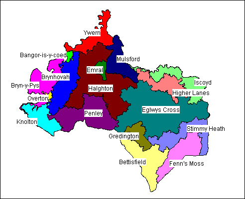
Maelor Saesneg represents a diverse and well-preserved historic landscape. The following description, taken from the Register of Landscapes of Special Historic Interest in Wales (Cadw 2001, 16-19), identifies the essential historic landscape themes in the historic character area that are considered in greater detail in the sections which follow.
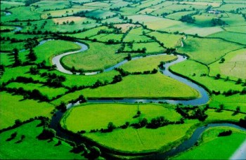
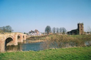
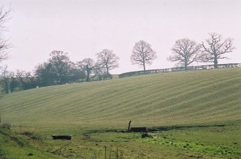
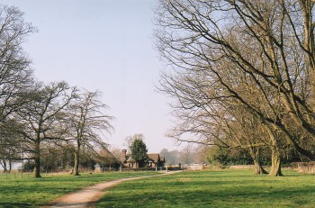
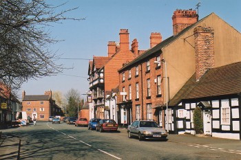
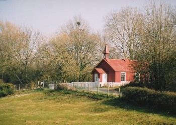
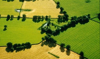
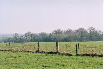
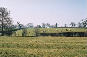
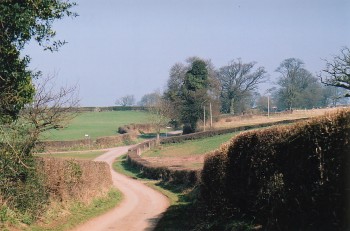
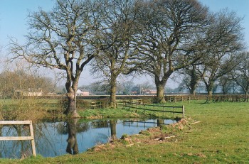
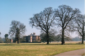
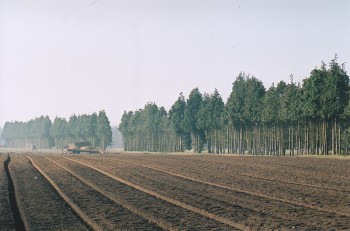
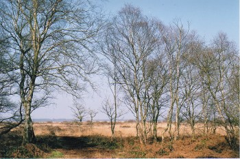
Geographically, Maelor Saesneg is that part of the pre-1974 county of Flintshire south east of the River Dee, formerly known as Flintshire Detached, and lying on the western fringes of the North Shropshire and South Cheshire plain. Topographically the landscape is uncharacteristic of Wales, with very little by way of prominent higher ground occurring, the otherwise flat or gently undulating surface of the plain reflecting the disposition in many places of extensive underlying deposits of materials left after the Ice Age. The surface of the plain drops almost indiscernibly from about 80m above OD at points along the southern limits of the area described here, to about 15m above OD on the flood plain of the River Dee which bounds the area on the north and west. The settlement pattern and economy of the area also owe much to influences from across the border in Cheshire, and consequently the historic character of the landscape is uncommon in Welsh terms, being more typical of the English border than of Wales and far more English than Welsh - as its name might suggest. Historically, the majority of Maelor Saesneg would have been subject to similar land use patterns with open fields divided into strips surrounding small medieval settlements. More recently, however, a distinction has arisen between the predominantly pastoral economy in the west and the arable fields of the east. As a result of arable farming, much of the landscape has been changed, with boundaries being removed to create larger fields and ploughing levelling all trace of former field system earthworks. Accordingly, the integrity of the historic landscape is best preserved in the western part of the area described here. Even so, in Welsh terms the scale of survival of this remarkable medieval field and cultivation pattern make this a very rare and valuable landscape. The area encompasses a number of historic settlements with their origins in the medieval or early medieval periods. To the west are the small towns of Bangor-on-Dee and Overton; Worthenbury (noted as the site of a possible Saxon burgh, and thus a great rarity in Wales) lies on the northern side; Penley and Lightwood Green to the south; and Horseman’s Green and Tallarn Green to the east. Many of these minor settlements tend to be small linear developments tightly packed along what must be assumed to be a pre-existing road network. Many are characterized by the red-brick houses and cottages locally typical of the 18th and 19th centuries. However, most possess one or two black-and white timber buildings indicating earlier origins, as might be inferred from the elaborate field systems surrounding many of these hamlets. One exception to this pattern is Bangor-on-Dee which, while having many architectural similarities with its neighbours, clearly has a much older pedigree. Here was the site of a Dark Age monastery where the Venerable Bede records that 2000 monks were massacred, though the site of this is now lost. The town has a scattering of medieval buildings and a fine 15th-century stone bridge spanning the River Dee; today the town is perhaps better known for its racecourse, the only one in North Wales. In addition to these settlements, there are several splendid late medieval hall houses such as Althrey and Penley Old Hall, together with a significant number of early medieval moated sites, as for example at Halghton Lodge and Peartree Lane. Most moated sites were of manorial status, being the residences of lords or their stewards, or occasionally belonging to church institutions. Dating evidence indicates that this distinctive settlement form was introduced into the area in the 12th century with a proliferation of sites appearing in the 13th and early 14th centuries, thereafter continuing to be built and remaining in use until the 16th century. Their defensive capabilities were negligible; instead their function appears to have been to proclaim the high status of their occupants, with the moats most likely to have been used for keeping fish and game birds, watering stock, and for ornament. However, it is the legacy of medieval agriculture which gives this landscape area its most distinctive characteristic. The land use pattern is currently one of small hedged fields, often arranged in narrow strips, many of which retain the ridge and furrow earthworks of medieval cultivation. Such earthworks were the result of arable cultivation during the medieval period when the land surrounding settlements was divided into strips within large open fields and worked in common by the villagers. Although the ridge-and-furrow visible today was created by ploughing these strips, the pattern of small enclosed and hedged fields occurred later. Over time, the open fields were gradually enclosed, the new field boundaries often reflecting the shape of the former strips, producing typically long narrow fields. In some areas, however, such as those to the north of Sandy Lane and near Mulsford, the patterns of medieval cultivation are more complex and often at odds with later boundaries. The predominantly pastoral agriculture of more recent centuries has effectively fossilized the field patterns, retaining the ridge and furrow earthworks and the later hedged fields, and leaving a distinctly medieval feel to the landscape. Many of these fields contain small ponds and although the origin and use of these is not clear, it is possible that they may be clay pits, perhaps each one providing building material for a local medieval building. These field systems should not be seen in isolation, however, since the settlements to which they belong are as much a part of the historic landscape. With the exception of Bangor on Dee and Overton, the settlement pattern remains one of small nucleated villages and hamlets which have changed little in plan since their medieval origins, adding coherence and integrity to the historic character of this very unusual, albeit still thriving and predominantly agricultural, Welsh landscape.
Historic landscape themes in Maelor Saesneg
 Ornamental and Picturesque Landscapes
Character areas
|
|
|
Click here for further information about this Historic Landscape Character area |
|
|
|
|
|
Click here for further information about this Historic Landscape Character area |
|
|
|
|
|
Click here for further information about this Historic Landscape Character area |
|
|
|
|
|
Click here for further information about this Historic Landscape Character area |
|
|
|
|
|
Click here for further information about this Historic Landscape Character area |
|
|
|
|
|
Click here for further information about this Historic Landscape Character area |
|
|
|
|
|
Click here for further information about this Historic Landscape Character area |
|
|
|
|
|
Click here for further information about this Historic Landscape Character area |
|
|
|
|
|
Click here for further information about this Historic Landscape Character area |
|
|
|
|
|
Click here for further information about this Historic Landscape Character area |
|
|
|
|
|
Click here for further information about this Historic Landscape Character area |
|
|
|
|
|
Click here for further information about this Historic Landscape Character area |
|
|
|
|
|
Click here for further information about this Historic Landscape Character area |
|
|
|
|
|
Click here for further information about this Historic Landscape Character area |
|
|
|
|
|
Click here for further information about this Historic Landscape Character area |
|
|
|
|
|
Click here for further information about this Historic Landscape Character area |
|
|
|
|
|
Click here for further information about this Historic Landscape Character area |
|
|
For further information please contact the Clwyd-Powys Archaeological Trust at this address, or link to the Countryside Council for Wales' web site at www.ccw.gov.uk.
Privacy and cookies