Cymraeg / English


Your Community - Flint
Archaeology and early history of the town
|
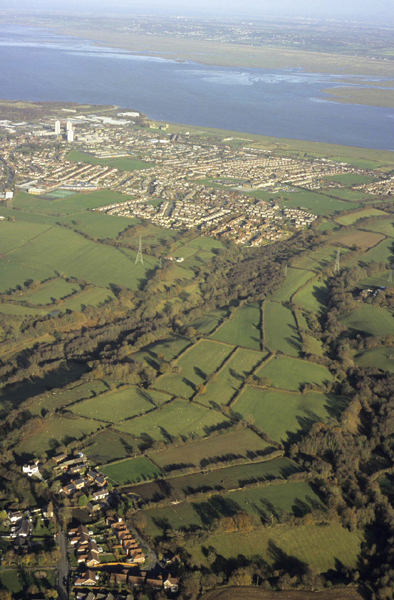
Flint in its landscape, seen from the south-west. The town can be seen spreading over the coastal strip beside the Dee Estuary, with the Wirral beyond. In the foreground a pattern reflecting medieval strip fields can be seen rising onto the end of Flint Mountain. Photo: CPAT 08-c-209.
|
Landscape Setting
Soils, largely formed from the glacial till, are mostly seasonally waterlogged reddish fine loamy and clayey soils which historically have been best suited to cereals and grassland. Several smallish streams running down from the limestone escarpment have cut shallow valleys through these softer rocks, loosely corresponding to geological fault lines. These streams enter the estuary by way of shallow creeks and channels, including that of the Swinchiard Brook on the western side of the town and the unnamed stream at Pentre Fwrndan to the east. The Swinchiard Brook – also sometimes formerly known as the Flint Brook – is fed by two streams draining from Halkyn Mountain, the Nant y Fflint and the Afon Conwy.