Cymraeg / English

|
East Fforest Fawr and Mynydd-y-glôg Historic Landscape |

|
Character area map |
|
|
More photographs |
Historic Landscape Characterisation
East Fforest Fawr and Mynydd-y-glôg:
Mynydd y Garn
Ystradfellte, Glyn Tarrell and Llanfrynach communities, Powys
(HLCA 1198)
Extensive moorland area with important traces of prehistoric settlement, land use and burial, together with evidence of medieval and later seasonal settlements and sheepfolds.
Environmental and historical background
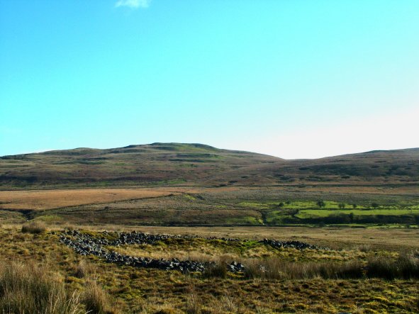
An extensive area of just under 2,500 hectares of predominantly unimproved and unenclosed moorland on the southern scarp of Fforest Fawr, dropping from over 730 metres above sea level on the summit of Fan Fawr to the north to about 300 metres along the margins of the enclosed land further to the south. The moorland is dissected by the small but deep stream valleys of the Afon Hepste draining to the south, the tributaries of the Afon Mellte to the west, and of the Afon Taf Fawr to the east. To the south the area broadens out into a shallow basin above the head of the enclosed ground within the lower Hepste valley. On the west the area is defined by steep, rocky scarps overlooking the valley of the Afon Mellte. On the east the land drops steeply into the valley of the Taf Fawr. There are extensive waterlogged areas around the headwaters of the streams and lower down towards the head of the Hepste valley, with exposed rock outcrops and screes on more exposed slopes to the east and on the more rugged terrain of Mynydd y Garn, Gwaun Cefnygarreg and Carn y Goetre to the west.The solid geology in the northern part of the area up to Fan Fawr and the eastern edge from Pant Brwynog to Pant y Waun is predominantly of Old Red Sandstone. The lower watershed of the Hepste is largely of Carboniferous Limestone with numerous shake holes, with the exception of the Gwaun Cefnygarreg and the Cefn Cadlan and Garn Ddu areas which are predominantly of sandstone but with some shake holes. Soils mostly overlying Old Red Sandstone or sandstone drift deposits, are predominantly seasonally waterlogged and acidic, and with a peaty surface horizon, which supports wet moorland of poor grazing quality. Towards the west smaller areas of better-drained land overlying sandstone in the Gwaun Cefnygarreg area, with better-drained land supporting moorland pasture of better grazing quality overlying limestone and in the Garn Ganol area.
The boundaries of the characterised area largely follow those indicated in the historic landscapes register, which are defined topographically along the scarp defining the Mellte and Taf Fawr valleys to the west and east respectively, with the exception that for convenience the boundary to the east has been extended to the edge of the modern woodland plantations around the head of the Taf Fawr valley. A fairly arbitrary boundary has been drawn to the south dividing it from the Cefn Cadlan – Cefn Sychbant character area, along the line of the A4059 trunk road and a footpath across the moorland.
In terms of the historic landscape characteristics of the area a subdivision could have been made about on the 400 metre contour since below this height there is a greater density of sites which appear to represent the maximum extent of all-year-round settlement at an earlier period, whilst above this level evidence of settlement and land use is much more slender and appears to have been largely of a seasonal nature. The absence of any physical divisions, however, makes it difficult to define a precise boundary.
Most of the area is registered Common Land, with the exception of part of Gwaun Cefnygarreg. The northern and western part of the area, west of the Afon Hepste and Nant y Cwrier and north of the Nant yr Eira fell within the Brecknock Forest (Fforest Fawr) enclosure acquired by Christie in 1818. Until local government reorganisation in 1974 the area fell within the Breconshire civil parishes of Glyn, Ystradfellte, Cantref and Penderyn.
Key historic landscape characteristics
Extensive area which today is largely of unimproved moorland with a single, isolated encroachment of about 6 hectares in extent of small irregular fields at Hepste-fechan which is possibly of later medieval or earlier origin. Modern post and wire fencing has been recently erected alongside the Nant yr Eira towards the north-eastern side of the area by the Commoners to prevent animals straying from one side of the mountain to the other. The enclosed portion of Gwaun Cefnygarreg included in this character area forms an area of moorland grazing enclosed by drystone walls.There is some uncertainty about the antiquity of the place name Fan Fawr, second highest peak in the Beacons, a name derived from the elements ban (‘summit, crest’) and mawr (‘large’). The name only appears to be recorded after 1900 and is seemingly referred to in early 19th-century sources as ‘y-Fan-dringarth’ after the Afon Dringarth river, a name which modern maps place over 2 kilometres further to the west.
Some indication of former land use is provide by place-name evidence but there is relatively little evidence relating to either settlement or industry, suggesting perhaps that much of this evidence relates to an earlier period than the mid 19th century onwards when most of the earliest maps of the area were being drawn. Boggy land is indicated by a number of place-names which include the elements cors (‘swamp, bog’) and brwyn (‘rushes’) in Cors y Beddau and Pant Brwynog respectively.
Gwaun (‘moor, mountain pasture’) is predictably, one of the most frequent place-name elements, as in Afon y Waun, Waun Llywarch, Pant y Waun, Waun Tincer, Waun Dywarch, Llynnau’r Waun, and Gwaun Cefnygarreg, emphasising that in economic terms the area has historically been mostly exploited for rough grazing though perhaps with islands of better grass in some lower-lying areas. The historical gathering of thin mountain hay on an area of Mynydd y Garn is possibly indicated by the element botel (‘bottle, bundle of hay or straw’) in the place-name Carn y Botel. An area of historically better grazing is perhaps indicated by the name Ton Teg (‘pleasant pasture’) given to the hillslope north of Hepste-fechan. Animal husbandry is only alluded to in a small number of place-names, including the element ychen (‘oxen’) in the stream name Nant yr Ychen and the element ffald (‘fold, pound’) in Ffald Newydd, a name first shown on Ordnance Survey maps published in 1890, in an area where several stone enclosures and a sheepfold are known on the banks of the Afon y Waun to the north-east of Hepste-fechan.
Unless derived from garw meaning ‘rough, uncultivated’, the place-name element in the stream names Garwnant Fawr and Garwnant Fach, Nant Carw (an earlier name given for Nant Sychbant) may be derived from carw ‘deer’. This, and the occurrence of the element iwrch (‘roe-deer, roe-buck’) in the stream name Nant Iwrch is of interest given that the character area fell within and on the margins of the former medieval hunting forest of Fforest Fawr.
The place-name element carn (plural carnau, ‘cairn, mound, rock, heap’) occurs frequently throughout the area, as in Carn y Goetre, Carn Ganol, Carn y Botel, Talcen y Garn, Cefn Esgair-carnau, Cefn Nantygeugarn, Mynydd y Garn, Garn Ddu, Carn, Nant y Geugarn, but generally appears to denote natural rock outcrops, particularly in the limestone area north of the Hepste valley, in the Mynydd y Garn area. The element bedd (plural beddau, ‘grave, resting place’) in Bedd Llywarch and Cors y Beddau may either refer to grave sites or possibly to a form of ancient Welsh family landholdings.
Surprisingly few place-name records relate to extraction and processing sites within the character area. Of those which are recorded by the Ordnance Survey, the name of the craggy outcrops at Twyn yr Odynau contains the element odynau (‘kilns’) and not surprisingly a couple of limekilns recorded on the 1st edition of the Ordnance Survey 1:2,500 map published in 1886 lie close by. The name Cwar Llwyd, which contains the element cwar (‘quarry’), refers to a small disused stone quarry in an area of Old Red Sandstone, unusually high up on the hill above Waun Llywarch.
Routes of communication are indicated by the element rhyd (‘ford’) which appears in the names Rhyd Uchaf and Rhyd ap Sion, by the possible element rhiw (‘slope, mountain track’) in Cefn yr Henriw (? ‘ridge of the old track’), leading up to Fan Fawr.
The character area includes a number of significant areas of ancient settlement and land use at different elevations dating from the prehistoric period up to medieval times and beyond.
An important area of early abandoned settlement and land use extends to an area of about 70 hectares in the upper valley of the river Hepste between a height of between 320-400 metres above sea level, extending into the tributary stream valleys of the Nant Hepste-fechan and Afon y Waun and onto the sheltered east-facing slopes of Mynydd y Garn and Waun Tincer. These lower-lying traces of land use and settlement appear to represent all-year-round settlement and agricultural activity during favourable climatic periods probably during the prehistoric and medieval periods just beyond the modern limits of enclosure. Visible remains include numerous prehistoric drystone round huts some of which are associated with irregular linear drystone walls and banks some forming irregular curvilinear enclosures of 0.4-3 hectares in extent and clusters of clearance cairns which appear to denote cultivation. In addition there are groups of rectangular building platforms with the remains of stone-built long huts, clustered especially along the Afon Hepste stream below the 380-metre contour which probably represent settlement and land use in the medieval to earlier post-medieval period. The round huts are generally between 4.5-10 metres in diameter and the majority of the clearance cairns are between 2-10 metres in diameter. An isolated group of round-huts of possible prehistoric date is also recorded at Carn Caniedydd, towards the eastern side of the area, at between 400-410 metres. There is a detached moorland encroachment of about 6 hectares in extent at Hepste-fechan, between a height of 330-370 metres. The encroachment, subdivided into a number of smaller walled fields, is first represented on a map of the Tredegar Estate dated 1780-81 but probably represents the partial survival and enhancement of a much earlier period of land use activity.
Traces of settlement become more sparse at higher elevations. Several small clusters of round huts probably of prehistoric date, rectangular huts probably of medieval date and occasional small embanked enclosures are known at heights of between 430-480 metres on Cors y Beddau — on the spur between the Nant Ganol and Nant Mawr streams, close to the Nant Llywarch stream, on Waun Llywarch — between the Nant Llywarch and Afon y Waun streams, and also at several locations next to the Afon y Waun stream. These higher traces of early settlement are less often associated with traces of cultivation in the form of field banks or clearance cairns and generally seem more likely from the medieval period at least to represent hafodydd (‘summer houses’) associated with transhumance and the seasonal exploitation of upland pastures during the summer months. Past animal herding up until the recent past is probably also represented by a scattering of crude stone shelters on the higher slopes of the mountain.
Personal names occur in a number of place-names including ap Sion in Rhyd ap Sion, and Llywarch in Waun Llywarch and Nant Llywarch.
Several burnt mounds have been recorded in the character area. These are characteristically horseshoe-shaped mounds of burnt stones of a kind which are best interpreted as middle to later Bronze Age sauna baths of some kind, though some may have been used as cooking sites. The known examples in the area characteristically lie adjacent to streams and on the periphery of or isolated from evidence of possibly contemporary land use and settlement. One site is known on the bank of a small tributary of the Garwnant Fawr stream on the eastern side of Cefn Esgair-carnau, overlooking the valley of the Taf Fawr. Another has been identified on the bank of a tributary of the Afon y Waun stream, on the edge of known settlement activity.
An important component of the evidence for early land use and activity in the character area is provided by round cairns of loose stone between about 6-18 metres in diameter and generally less than 1 metre high which represent burial monuments of early Bronze Age date, none of which have been excavated in modern times. Few of the monuments appear to have any specific names of any antiquity though as noted above they have given rise to the place-name elements carn and carnau which are met with frequently in the area. The only two exceptions are Carn Caniedydd (‘singer’s, song-writer’s cairn’) and Garn Wen (‘white cairn’) where the element appears to apply to prehistoric burial cairns, which in the first instance possibly refers to the whistling of the wind in this exposed location, or to be derived from a personal name, or to have folkloric or legendary associations. The monuments generally lie between a height of 350-450 metres, avoiding both the higher and lower ground, and their distribution largely complements rather than overlaps the traces of early settlement and land use with which they are likely to be in part contemporary.
The monuments appear singly, or pairs or in larger clusters and generally appear to be deliberately sited on hill-slope or hill-crest location in which they are visible from lower ground. The majority of sites in the character area occur loosely around the fringes of the upper Hepste valley and its tributaries – on the east-facing slopes of Mynydd y Garn, the south-facing slopes of Ton Teg, and the west-facing slopes of the significantly named Cefn Esgair-carnau. Other smaller groups occur on the west-facing slopes overlooking Pen-fathor in the Afon Dringarth valley, and the east-facing slopes above Pant y Gadair and Twyn Garreg-wen, overlooking the valley of the Taf Fawr. A majority of the monuments appear to be well-preserved although small intrusions have been dug into some and others have been adapted to form sheep shelters.
A handful of sheepfolds are known in the area sited either around the margins of the moorland area such as above Pen-fathor-uchaf and Garreg-fawr on the west, or at other convenient points for gathering sheep from the hills, such as on the eastern edge of Mynydd y Garn and along the Afon y Waun stream, many of which have now gone out of use. These structures, though some are possibly based upon the sites of earlier hafodydd (‘summer houses’), probably largely represent a phase of intensive sheep farming following the eclipse of the medieval system of transhumance based upon cattle ranching and dairying, and also probably in some instances stemming from the agricultural improvements of the later 18th and early 19th centuries. There is documentary evidence for some of the sheepfolds near Pen-fathor in the 1770s. Further indications of dating are given by the two sheepfolds on Glog-las which are both described as ‘Old Sheepfold’ on Ordnance Survey maps of the 1880s, and by Ffald-newydd (‘new fold’), close to the Afon y Waun, which appears on an Ordnance Survey map of 1890.
An extensive area of up to about 200 hectares at the headwaters of the Afon Hepste and its tributaries appears to have been drained perhaps during the latter stages of or just after the second world war by a network of straight drainage channels up to 400 metres long and spaced at intervals of 8-18 metres most clearly visible from the air, presumably in an attempt to improve the grazing potential of the moorland pasture below Fan Fawr. Most of the drainage trenches have now largely silted up and eroded into more irregular courses and often have the appearance of natural watercourses.
There is a small amount of former industrial activity in the area of limestone outcrops close to the western boundary of the character area represented by groups of limekilns and small quarries close to the moorland edge which no doubt were used to produce agricultural lime. One bank of kilns on Carn y Goetre is linked by former tracks with Garreg-fawr and Llwyn-onn farms. In at least one instance there is a double kiln. Another group of kilns lie close to the significantly named Twyn y Odynau, containing the place-name element odynau (‘kilns’), to the south-east of the former farm at Pen-fathor-uchaf. In some instances the limekilns are relatively well-preserved with standing masonry whilst in others they are represented by grassed-over mounds. Some of the kilns are shown on Ordnance Survey maps of the 1880s, though in at least one instance the structure is described as an ‘Old Limekiln’.
Part of the southern boundary of the area is drawn along the line of the earlier 19th-century Hirwaun-Brecon turnpike road (the modern A4059), the surviving remains of which include several small roadside quarries and milestones.
Peaty areas, buried soils and other sediments in the area have a considerable potential for reconstructing past land use and environmental change.
Sources
Historic Environment Record; Ordnance Survey 1st edn 1:2,500; Leighton 1997; Soil Survey of England and Wales 1983; Kain and Chapman 2004; Chapman 1991; RAF vertical air photography dated November 1945 and May 1946; Powell 1998/99.For further information please contact the Clwyd-Powys Archaeological Trust at this address, or link to the Countryside Council for Wales' web site at www.ccw.gov.uk.
Privacy and cookies