|
 Aerial view of disused limestone quarry workings and limekilns just to the north of Cadair Fawr, viewed from the west in a landscape pitted with shake holes. In the right background is the main road (A4059) between Penderyn and Brecon, which originated as a turnpike road in the early 19th century.
Photo: CPAT 08-C-71.
Aerial view of disused limestone quarry workings and limekilns just to the north of Cadair Fawr, viewed from the west in a landscape pitted with shake holes. In the right background is the main road (A4059) between Penderyn and Brecon, which originated as a turnpike road in the early 19th century.
Photo: CPAT 08-C-71.
|
|
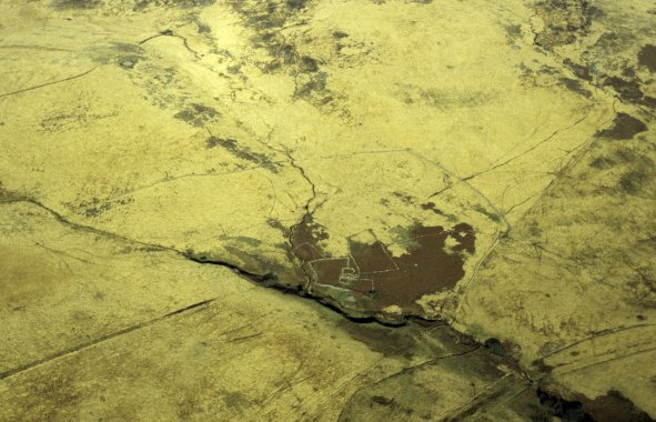 Aerial view of a small farmstead on the edge of a stream valley north of Nant-moel-Uchaf, on the south side of Mynydd-y-glog, viewed from the south. The farmstead, perhaps originating in the later medieval or early post-medieval period, is already shown as having been abandoned on an Ordnance Survey map of 1885.
Photo: CPAT 08-C063.
Aerial view of a small farmstead on the edge of a stream valley north of Nant-moel-Uchaf, on the south side of Mynydd-y-glog, viewed from the south. The farmstead, perhaps originating in the later medieval or early post-medieval period, is already shown as having been abandoned on an Ordnance Survey map of 1885.
Photo: CPAT 08-C063.
|

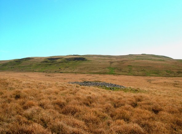 Cefn Cadlan viewed from the north-west with an isolated Bronze Age burial cairn in the Hepste valley in the foreground.
Photo: CPAT 2509-32.
Cefn Cadlan viewed from the north-west with an isolated Bronze Age burial cairn in the Hepste valley in the foreground.
Photo: CPAT 2509-32.
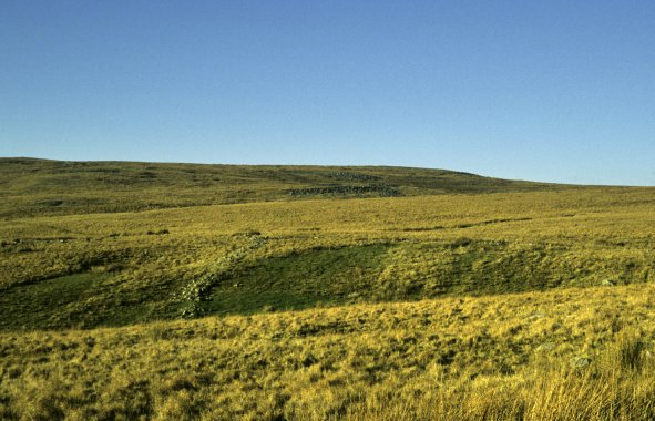 Relict field wall in left middle distance on southern slopes of Cefn Cadlan viewed from the south.
Photo: CPAT CS07-06-29.
Relict field wall in left middle distance on southern slopes of Cefn Cadlan viewed from the south.
Photo: CPAT CS07-06-29.