Cymraeg / English

|
Maelor Saesneg Historic Landscape |

|
Character area map |
Historic Landscape Characterisation
Maelor Saesneg:
Knolton
Overton community, Wrexham County Borough
(HLCA 1119)
 Scattered farms and irregular fields of medieval and late medieval origin and irregular fields with discrete area of former medieval open field.
Historic background
Much of the character area formerly fell within the township of Knolton in the 19th-century ecclesiastical parish of Overton. Early settlement of perhaps the 8th or 9th centuries is suggested by the Old English place-name elements cnoll and tun ('knoll settlement'), though the name itself if first recorded in the early 14th century.
Key historic landscape characteristics
The character area occupies a ridge of higher ground along the south-western boundary of Maelor Saesneg, generally between 50-90 metres above Ordnance Datum, which slopes gently to the north-east and more steeply to the wooded slopes along the Dee valley on the north-west and the Shell Brook on the south-west, the latter of which forms the boundary with England.The predominant fieldscape within the character area is one of large and small irregular fields which may derive largely from piecemeal woodland clearance and enclosure from the Middle Ages onwards, though a discrete pattern of strip fields in the area of Knolton suggests a discrete area of medieval open field cultivation, which perhaps correspond with documentary references to open strip fields in the 13th and 14th centuries. Relatively little ridge and furrow cultivation is recorded within the area though it includes a dense scatter of marl pits. Modern land use is mostly permanent grassland, fields generally being bounded by low cut multi-species hedges.
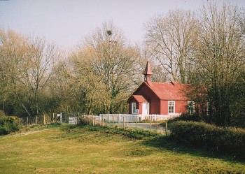
Settlement is characterized by a of widely dispersed farmsteads suggesting medieval and later freehold farming, a scatter of cottages and smallholdings in the area to the south of Rhewl, and the loosely nucleated farms and houses in the hamlet of Knolton Bryn. A number of the houses have early origins, including the Llan-y-cefn farmhouse, originally a probably 15th/16th-century cruck-built building now faced in brick. Knolton Hall, Top Farm farmhouse, Gwalia farmhouse and Model Farm, though substantially remodelled or extended in the 18th and 19th centuries, all preserve evidence of earlier timber-framed phases probably of the 16th century, Knolton Hall having been remodelled to form a substantial country house. Llan-y-cefn, Gwalia and Top Farm all have characteristic complexes of outbuildings indicating relative prosperity during the 18th and 19th centuries, including byre, stable and cartshed at Gwalia, a stable range, summerhouse, icehouse, coachhouse and cowhouse at Llan-y-cefn. Characteristic of smaller farms and smallholdings in the character area is The Homestead, a small 19th-century house and barn, all under the same roof, of a type which was probably once much more common in the area. The cluster of buildings at Knolton Bryn appears to overlie an area of former medieval open field, suggesting that the settlement here may owe its origin to a period of enclosure in the post-medieval period. Lying a little distance from the parish church at Overton, Knolton was provided with a corrugated-iron mission church in the 1890s, typical of the kind of subsidiary often provided for scattered rural communities of this kind, lying at a little distance from the parish centre.
Substantial improvements to the public roads in the character area in the late 18th and early 19th centuries, the visible legacy of these improvements being the several milestones with cast-iron plates on the former turnpike road between Ellesmere and Wrexham (A528) and Barton's Bridge, a small, stone-arched road bridge across the Shell Brook, on the border between England and Wales, said to have been built by Thomas Telford in 1819. During the 20th century, between 1914-62 the area was served by the small station at Trench Halt, on the Wrexham and Ellesmere railway line, of which little trace now survives.
Sources
Baughan 1991Charles 1938
Sylvester 1969
Listed Building lists
Regional Sites and Monuments Record
For further information please contact the Clwyd-Powys Archaeological Trust at this address, or link to the Countryside Council for Wales' web site at www.ccw.gov.uk.
Privacy and cookies