Cymraeg / English

|
Maelor Saesneg Historic Landscape |

|
Character area map |
Historic Landscape Characterisation
Maelor Saesneg:
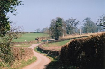
Eglwys Cross
Bronington, Hanmer, Maelor South and Willington Worthenbury communities, Wrexham County Borough
(HLCA 1125)
 Landscape dominated by irregular field patterns and scattered farms, with early nucleated church settlement at Hanmer and a handful of later 'green' and roadside settlements.
Historic background
Earlier prehistoric settlement and land-use of at least part of the area is indicated by two Bronze Age burial mounds north of Whitewell, one partially excavated in the late 19th century, and possible similar sites at Waenreef Farm and Bryn Rossett. Early medieval settlement of perhaps the 8th to 10th century is suggested by a number of place-names ending with the Old English element -tun indicating a Saxon settlement or farm, as in the case of Willington and Bronington, though in none of these instances are early forms of the names recorded: Willington, for example is first recorded as 'Gwillington' in 1284 but Bronington is first recorded in the late 17th century. The place-name Croxton may indicate Viking settlement. Hanmer is unnamed in the Domesday survey of 1086 though the existence of the church here, which may be of Anglo-Saxon origin, may be indicated by the presence of a priest said to hold land at Bettisfield (Bedesfield) at that date, though the church itself, dedicated to St Chad, it first documented in 1110 when it was gifted with other lands to the Augustinian abbey at Haughmond, Shropshire. The area is crossed by a number of important routeways linking Overton and Bangor with the neighbouring town of Whitchurch in Shropshire. The strategic importance of these routes during the Edwardian conquest is indicated by a writ of 1282 authorizing William le Botiler of Wemme, captain of Edwards garrison at Whitchurch, to clear trees from the pass at Redbrook (La Rede Broc), presumably on the line of the present A525.Key historic landscape characteristics
The historic landscape character area forms an undulating and hummocky area of morainic drift, generally between 30-90 metres above Ordnance Datum, dissected by shallow valleys of streams which are tributaries of the Wych Brook to the north-east and the Emral Brook on to the north-west. Meres and mosses such as Llyn Bedydd, Croxton Pool and Cranberry Moss and with poor natural drainage have formed in hollows left by the deposition of glacial till, Llyn Bedydd being fringed with mixed deciduous woodland including birch and sycamore.Fieldscapes are dominated by large and small fields with irregular boundaries which have probably resulted from piecemeal encroachment and enclosure, though there are some smaller areas of strip fields such as those to the north of Fenn's Old Hall, to the north-east of Hanmer, west of Peartree Farm and to the north of Eglwys Cross which appear to owe their origin to former areas of medieval open field, some of which are associated with remnant areas of ridge and furrow cultivation. Former arable is also represented by field lynchets in some areas. Wetter, low-lying areas to the east of Eglwys Cross were drained and improved, probably in the post-medieval period, and there is a widespread distribution of marl pits, most of which survive as water-filled ponds and hollows. Modern land use is predominantly pasture though there is some arable, mostly for the cultivation of fodder crops. Field boundaries are mostly marked by mixed-species hedges, with scattered mature oak trees.
Physical evidence of early settlement is provided by the motte known as Mount Cop at Eglwys Cross and by the unusual possible circular moated site just to the east of Hanmer, both of which are lacking certain historical associations. The small nucleated settlement at Hanmer is possibly of Anglo-Saxon or Norman origins, though there is there are evidently few other medieval manorial centres or nucleated settlements in the character area, suggesting that settlement during this period was predominantly based upon scattered farmsteads. A high proportion of modern farms have English names, such as Yew Tree Farm, The Fingers, Broad Oak, and Cranberry Farm, though historical evidence for farm and field names suggests that there had been a significant Welsh cultural element in the later Middle Ages. Several 'green' settlements, such as those at Horseman's Green, Little Green, and Painters Green, probably represent post-medieval enclosure of former areas of common grazing, the linear settlements at Broughton, The Chequer, Whitewell and Little Arowry probably having largely emerged as a consequence of the improvements to the turnpike roads in the later 18th and earlier 19th centuries. Elsewhere there are ancient winding lanes, sometimes set within hollow-ways.
An earlier horizon of houses in the character area is represented by relatively rare appearance of late medieval and early post-medieval half-timbering at the thatched Magpie Cottage, Hanmer, Peartree Farm, and at The Cumbers, the latter a late 19th-century brick-built house with half-timbered gables. A high status late medieval manorial centre is indicated by the late 15th-century timber-framed aisled hall at Horseman's Green, also later encased in brick. Many of the surviving higher status houses are 18th-century brick-built structures in a Georgian vernacular style, such as the early 18th-century vicarage at Hanmer, Croxton (1793), Hanmer Hall (1756)
Sources
Berry & Gale 1966aCharles 1938
Davies 1949
Edwards 1991
Hubbard 1986
Lee 1876
Musson 1994
Sawyer & Hacker 1987
Silvester et al. 1992
Smith 1988
Smith 2001
Sylvester 1969
Listed Buildings lists
Regional Sites and Monuments Record
For further information please contact the Clwyd-Powys Archaeological Trust at this address, or link to the Countryside Council for Wales' web site at www.ccw.gov.uk.
Privacy and cookies