Cymraeg / English

|
Mynydd Hiraethog Historic Landscape |

|
Character area map |
Historic Landscape Characterisation
Mynydd Hiraethog:
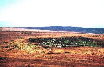
Moel Rhiwlug
Pentrefoelas and Cerrigydrudion Communities, Conwy
(HLCA 1106)
Heather moorland subdivided polygonal enclosures in the later 18th or early 19th century and managed as part of shooting estate in later 19th and in 20th century, with scattered prehistoric funerary monuments and medieval and later seasonal settlement evidence.
Historic background
The area falls within the 19th-century tithe parishes of Tiryrabad-isaf (Pentrefoelas) and a small part of Cerrigydrudion along the south-eastern edge. Intensive archaeological fieldwork was undertaken in about half the area during the 1980s and 1990s during the course of which a large number of previously unidentified archaeological sites were recorded, particularly relating to the later history of the moor, though the density of heather in many areas suggests that many sites still await discovery. Little detailed analysis has been undertaken, however, and the dating of many sites is uncertain.
Key historic landscape characteristics
The character area occupies an extensive undulating moorland area of about 29km2 on the south-western side of Mynydd Hiraethog, between a height of about 270-530m above Ordnance Datum, and includes highest point of the Denbigh Moors on Mwdwl-eithin, at a height of 532m. Other summits include Moel Llyn, Pen yr Orsedd, the southern slopes of Moel Seisiog, Pen Bwlch-y-garnedd, Graig Hir, Moel Derwydd, Penbryn-ci, Braich y Tarw and Moel Rhiwlug. There is no dominant direction of view within the area. Drainage is to the north by means of the Wauneos, Nant Goch, Caledfryn, tributaries of the Afon Cledwen which feeds the Afon Elwy river system, and the southward flowing streams of Llaethog, Twllan, Nug, Nant y Foel, and Cadnant, which are tributaries of the Conwy river system.
Early activity in the area is represented by a late Bronze Age socketed spear found at a height of 370m above OD on Ffrith-y-foel during peat cutting in the later 19th century. Early settlement, possibly of prehistoric date is represented by a number of scattered hut circles between about 5-6m in diameter, towards the south-eastern edge of the moor, two on Bwlch-y-garnedd, at the head of the Afon Twllan stream and one at the head of the Afon Nug, possibly associated with clearance cairns and traces of a relict field system, suggesting permanent settlement. A group of three circular platforms towards the centre of the moor, near the Afon Alwen north of Nant Heilyn, may also represent prehistoric settlement. Later settlement perhaps of medieval and early post-medieval date is represented by a variety of long-abandoned structures scattered across the moorland including building platforms or the stone foundations of long huts up to about 15m by 6m across often sited in more sheltered stream valleys, sometimes in small groups but more often appearing singly. Some of the structures seem likely to be temporarily occupied summer dwellings or hafodydd associated with the exploitation of upland pasture, though a number of structures, as for example on the south side of Mwdwl-eithin, appear to be associated with banked enclosures and stone clearance cairns, suggesting all-year-round occupation for a period in perhaps the post-medieval period. Permanent settlement in the later medieval or early post-medieval period is also hinted at by the find of the lower quernstone of a hand-mill found at a height of 390m above OD on Moel Derwydd. All settlement sites within the area had been abandoned by at least the early 19th century, none being shown on the Tiryrabad-isaf (Pentrefoelas) or Cerrigydrudion tithe maps.
A number prehistoric burial cairns and other similar structures are to be found within the area, sometimes appearing singly, though more frequently in small groups within several hundred metres of each other. There is no clear association with contemporary settlement sites and it is possible that the cairns may also have helped to define the territories of different family groupings. Small groups of this kind are to be seen on the east side of Moel Seisiog, the west side of Moel Rhiwlug, and on the southern slopes of Pen yr Orsedd. The cairns range from between about 2.5m and 11m in diameter and in some cases have a central burial cist or an outer kerb of stones. Other possible prehistoric ritual monuments include an oval setting of seven large stones near Nant Heilyn.
Medieval, post-medieval and later exploitation of the extensive but poor-quality grazing of the moors is represented by drystone sheepfolds and sheep shelters, some still in use but others long-abandoned. The shelters take a variety of shapes to provide protection from whichever direction the wind blew. Much of the formerly open moorland was first subdivided by fences into large polygonal enclosures probably in perhaps the later 18th or earlier 19th-century, for the purpose of managing flocks of sheep, new boundaries continuing to be established here in the later 19th century.
Numerous boundary stones and marker cairns of different forms are to be found within this otherwise featureless moorland, most of which are probably 18th-century or later in date, and often defining indistinct parish boundaries, other boundaries being marked by streams. Marker stones and some marker cairns between 50-200m apart between the tithe parishes of Gwytherin and Tiryrabad-isaf (Pentrefoelas) tithe parishes. A number of boundary stones on the boundary between the Pentrefoelas and Cerrigydrudion parishes are inscribed HIRAETHOG or with a location such as HIRAETHOG/GARREG LWYD or HIRAETHOG/PONT ALICE HUGH some of which in this instance appear to have been set at intervals of 2 furlongs (440 yards). Other marker cairns, probably of 19th or earlier 20th- century date, are sited singly or in groups on or near local summits and appear to be related to the management of the shooting estate, sometimes evidently marking shooting butts. Some take the form of drystone pyramidal cairns about a metre across and a metre high.
Other features associated with the management of the former shooting estate include numerous shooting butts and shelters, the former including a variety of circular, rectangular or semi-circular shapes defined by banks or stone walls up to 3-4m across, occasionally built from earlier structures. The shooting shelters are small and now derelict rectangular drystone structures, 3-5m across, formerly roofed, and sometimes provided with a chimney and stone benches. The shooting butts occur in a number of distinct groups of 3 to 6, and often set out in a line 80-100m apart, sometimes along a footpath. Groups of this kind are to be found on Moel Seisiog, Penbryn-ci, Moel Derwydd, Pen yr Orsedd, Bwlch-gwyn, Bwlch-y-garnedd, Nant Heilyn on the west side of the Afon Alwen, and on the flanks of Mwdwl-eithin.
The area is crossed by the modern Pentrefoelas to Denbigh road (A543) constructed as a new turnpike road in the early 19th century via Sportsman's Arms and Bylchau and with a toll-house on the moorland edge at Turpeg Mynydd, replacing the older road across the moor via Nant-heilyn, Tan-y-graig and Nantglyn which is likely to be medieval or earlier in origin. A number features relating to the construction of the turnpike road have survived including the stone single-arched Cottage Bridge, small roadside stone quarrries, and occasional stretches of roadside walling and revetments. The larger roadside stone quarry at Bwlch-gwyn began life in the later 19th century, following in the wake of the new turnpike road. Other trackways and footpaths linking communities on the north and south sides of the moor.
The former exploitation of peat on a domestic scale, probably up until about the 1950s, is represented by rectangular peat cuttings, drying platforms and abandoned peat stacks especially within the more prominent stream basins, as on Bwlch-y-garnedd, the south side of Mwdwl-eithin and the south side of Penbryn-ci. Small-scale stone quarrying for the construction of walls, shelters and sheepfolds are scattered across the moor, as on Craig-hir, Mwdwl-eithin and Pen yr Orsedd. There are also a number of quarries near the moorland edge probably used for the construction of lower-lying farmhouses and outbuildings, as in the case of a concentration of small quarries on the ridge above Bryn-du, north of Glasfryn.
Peat deposits, buried soils and sediments are to be found in various locations within the moorland, few of which have been studied, but which represent an important resource concerning the vegetational and land use history of Mynydd Hiraethog.
Sources
CPAT Sites and Monuments Record
For further information please contact the Clwyd-Powys Archaeological Trust at this address, or link to the Countryside Council for Wales' web site at www.ccw.gov.uk.
Privacy and cookies