Cymraeg / English

|
Mynydd Hiraethog Historic Landscape |

|
Character area map |
Historic Landscape Characterisation
Mynydd Hiraethog:
Maen-llwyd
Nantglyn and Llanrhaeadr-yng-Nghinmeirch Communities, Denbighshire
(HLCA 1113)
Heather moorland with some improved grassland, partly divided into large polygonal enclosures of 18th/19th century date, Bronze Age funerary and ritual landscape, enclosed medieval sheepcotes, medieval and later hafodydd and farmsteads, archaeological trail.
Historic background
The area falls within the 19th-century tithe parishes of Nantglyn, Llanrhaeadr-nyg-Nghinmeirch, and Cyffylliog. Intensive archaeological fieldwork has been undertaken in the area, particularly in advance of the construction of the Brenig Reservoir in the early 1970s.
Key historic landscape characteristics
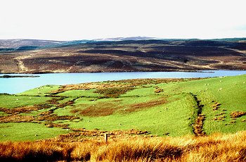
The character area occupies a moorland area of just under 7km2 on the eastern side of Mynydd Hiraethog, on the north and north-east sides of the Brenig Reservoir, at a height of between 380-519m above Ordnance Datum. The area includes the summits of Bryn Maen, Tir Mostyn, Foel Goch, Bryn yr Hen-groes and Bryniau. Views are predominantly focussed inwards on the valley of the Afon Fechan, now occupied by Brenig Reservoir. Drainage to the south is provided by the Nant Bryn-morwyn, Afon Fechan, Aber Gors-maen-llwyd, Nant-y-criafolen, Aber Llech-Damer, Aber Berbo and Afon Brenig, tributaries of the Afon Alwen, which joins the river system of the Dee.
In view of the elevation of the area it includes a surprisingly full record of settlement and land use from early prehistoric times up to the recent past, some of which has left visible traces in the modern landscape. Possibly seasonal settlement by Mesolithic and Neolithic hunting parties is represented by pits and hearths associated with lithic material dating to the period between about 6500-3000 BC and by sherds of Beaker pottery dating to about 2000 BC, found during archaeological excavations in the 1970s. During a period of half a millennium or more in the early Bronze Age, between about 2000-1500 BC, the area appears to have become a landscape reserved for ceremonial activities focused upon a complex of funerary and ritual mounuments including turf barrows, stone cairns, a kerb cairn and a platform cairn, around the head of the Afon Fechan valley, many of which form part of the Brenig archaeological trail. These monuments evidently built by a community which continued to exploit the surrounding upland pastures but whose permanent settlements occupied the more sheltered lower-lying ground to the south. A similar though possibly distinct community is possibly represented by a pair of kerb cairns on Tir Mostyn, towards the north-east corner of the character area.
Possible settlement in the middle Bronze Age, perhaps of a seasonal nature is suggested by a circular posthole structure found during the excavations of one of the monuments. Iron Age settlement of perhaps a similar nature, dating to perhaps the 1st/2nd century BC is represented by a second circular posthole structure. Climatic deterioration may have led to the abandonment of these early settlements during the Roman and early medieval periods though reoccupation, possibly on a seasonal basis, re-emerged during the medieval period, suggested by the occurrence of place-names such as Hafoty Sion Llwyd including the element hafod 'summer house' and again possibly associated with communities further to the south and possibly to be associated with cattle husbandry. The date at which some of these smaller-scale dwellings on the upland waste were first established is uncertain, though some, like Hafod-lom (in the adjacent Brenig Reservoir character area) might be of medieval origin.
Larger-scale medieval exploitation of the upland pastures is represented by the remarkable earthwork enclosure at Hen Ddinbych enclosing a number of platforms which appear to represent roofed sheepcotes which probably enabled flocks of sheep to be overwintered on the mountain for the production of wool and other produce. The site was already in existence by the early 1280s and referred to Bisshopswalle. The complex would have necessitated considerable capital expenditure by a major landowner, the name implying an investment made by an as yet unidentified ecclesiastic. The venture may have been relatively short-lived since by the 1330s the associated pasture, evidently at this time used for cattle rearing, was being sold annually to the local community by the lordship of Denbigh.
The remarkable cluster of seven dwellings represented by platforms, house foundations and enclosures along the banks of the Nant-y-criafolen stream, which have been shown by archaeological excavation to date to the 15th/16th century, though there is some uncertainty about whether they may have been occupied throughout the year. A small number of permanently occupied farmsteads had certainly become established by the 18th and 19th centuries including the now dilapidated pair of stone-built and formerly thatched 18th-century single-storey cottages at Bwlch-du and the small two-story stone farmhouse at Hafoty Sion Llwyd, rebuilt in the 1880s but now abandoned, associated with embanked fields of improved grassland up to 6-7ha in extent, enclosed from the surrounding moorland. There is no certain evidence of cultivation at any period, though a group of undated stone clearance cairns is recorded on Waen Ddafad.
Further enclosure of the moorland was being undertaken during the 19th century for the control of stock and pasture improvement in some areas, much of the area being subdivided into large polygonal enclosures, as for example on Tir Mostyn, with larger enclosured defined by large earthen banks being subdivided by lighter post-and-wire fences. In the 1930s former fields and boundaries to the east of the character area became submerged below the conifereous plantations of Clocaenog Forest.
Little trace now survives of the important routeways which once ran through the area, linking communities to the north and south of the moor. Before the construction of the Pentrefoelas-Denbigh turnpike in the early 19th century and the construction of the Brenig Reservoir the head of the Afon Fechan valley between Hafoty Sion Llwyd and Bwlch-du formed the hub of a local network of roads and trackways where the old route from Pentrefoelas to Denbigh via Nantglyn joined routes from Cerrigydrudion to Denbigh and Nantglyn running via Elorgarreg.
Waterlogged and peaty deposits up to 3m deep still survive within the area, notably in the natural basin between the Afon Fechan and Aber-gors-maen-llwyd streams, which continue to provide a resource of significance to understanting of the vegetational and land use history of Mynydd Hiraethog. Peat digging is recorded in the tithe apportionment for the parish of Llanrhaeadr-yng-Nghinmeirch on Tir Mostyn and in the area to the west of Bwlch-du but the surviving archaeological evidence of this domestic industry is unknown.
Sources
Allen 1979;
Burnham 1995;
Davies 1977;
Dyer 1995;
Gresham, Hemp & Thompson 1959;
Lynch 1993;
Musson 1994;
Silvester forthcoming
For further information please contact the Clwyd-Powys Archaeological Trust at this address, or link to the Countryside Council for Wales' web site at www.ccw.gov.uk.
Privacy and cookies